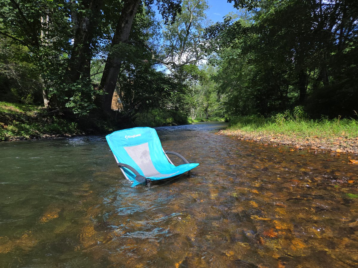
Suches, GA is a small mountain community in the Chattahoochee National Forest, about 90 miles north of Atlanta and 30 minutes from Blue Ridge. Known as the Valley Above the Clouds, it sits at around 2,700 feet, surrounded by ridgelines and gaps that reach over 3,200 feet. The Toccoa River runs through it. The roads around it are famous. Most people who end up here either came for the fishing, the riding, or the quiet — and they tend to come back.
Where Is Suches, GA
Suches is in the North Georgia mountains, in the zip code 30572. It spans both Fannin and Union counties — which county your address falls in depends on exactly where in Suches you are. The community is not an incorporated town. There is no city hall, no downtown grid, no traffic light. It is a rural mountain community centered on a river valley with a post office, a country store, and the roads that run through it. The Suches school serves kindergarten through 12th grade and is widely recognized as the smallest public school in Georgia, with around 50 to 60 students total.
The geography matters here. Suches sits in a valley carved by the Toccoa River, with Chattahoochee National Forest land on nearly every side. The nearest full-service towns are Blue Ridge to the north (about 30 minutes), Blairsville to the northeast (about 25 minutes), and Dahlonega to the south (about 45 minutes). Wolf Pen Gap Country Store and Coopers Creek Store both sell gas within the community.
Your North Georgia mountain getaway is waiting. Bring your dog. Pack your rod. Leave your stress.
Suches is not a resort town. There are no theme parks, no outlet malls, no manufactured attractions. What it has is the kind of thing people drive two hours to find and then can not stop thinking about.
Fish the Toccoa River
The Toccoa River is a blue ribbon trout stream. Rainbow and brown trout hold in cold, clear water year-round. The river is stocked by the state and managed for wild fish reproduction in the upper reaches. Sections of the river in Suches offer walk-in access at Deep Hole Recreation Area, and guided float trips are available through outfitters in Blue Ridge. See the Toccoa River trout fishing guide for water conditions, access points, regulations, and gear recommendations.
For a different experience, Black Mountain Trout Ponds and Fishing Shack in Suches is a pay-out pond where you keep what you catch. Bait and tackle are available on site, or bring your own. A good option for families who want a full day of fishing without wading a river. Hours are seasonal and weather-dependent — they post open and closed updates on their Facebook page. Call ahead at (706) 897-9985 or check Facebook before making the trip.
Ride the Suches Loop
The roads around Suches are legendary. The Suches Loop is a network of mountain gaps and valley routes — Hwy 60, Wolf Pen Gap Road, Skeenah Gap Road, and others — that draw motorcyclists and sports car drivers from across the Southeast. Wolf Pen Gap sits at about 3,360 feet. The curves are technical, the elevation changes are dramatic, and the scenery is worth stopping for. See the full North Georgia motorcycle rides guide for route details, difficulty ratings, and what to expect on each road.
Hike the Appalachian Trail and Benton MacKaye Trail
Woody Gap on Hwy 60 puts you on the Appalachian Trail in minutes from Suches. From there, the AT runs north toward Blood Mountain and south into the Chattahoochee National Forest. The Benton MacKaye Trail, which begins at Springer Mountain and runs north through the same territory, offers more solitude and less foot traffic than the AT corridor. Both trails are accessible as day hikes or multi-day segments. See the AT and Benton MacKaye hiking guide for trailheads, distances, and what to expect.
Visit the Waterfalls
Three waterfalls within a short drive of Suches make for easy day trips. Sea Creek Falls is the closest and most accessible, with a short walk from the trailhead to a cascade in the national forest. Helton Creek Falls is a two-tier drop with a natural pool at the base. Long Creek Falls sits on the Appalachian Trail near Woody Gap and rewards the hike with a wide, dramatic pour. See the North Georgia waterfalls guide for directions, trail lengths, and dog-friendly notes on each.
Walk the Toccoa Swinging Bridge
The Toccoa Swinging Bridge is a historic pedestrian suspension bridge over the Toccoa River near Blue Ridge, about 30 minutes from Suches. Most visitors to the area never find it. It sways underfoot, the view from the middle is worth the trip, and admission is a few dollars. See the Toccoa Swinging Bridge guide for parking, trail details, and what to expect.
Watch the Wildlife
Suches is real mountain habitat. Black bear, white-tailed deer, wild turkey, red fox, raccoon, and pileated woodpecker are all active in the area. Dawn and dusk are the best windows. The Chattahoochee National Forest surrounding Suches provides undisturbed movement corridors, so sightings close to properties are common. See the North Georgia wildlife guide for what lives here and what to do if you encounter it.
Attend the Indian Summer Festival
The Indian Summer Festival is Suches's signature annual event, held the first weekend of October at the peak of fall foliage season. Arts, crafts, live music, and food vendors set up in the heart of the community. Dogs are welcome. If you are staying in Suches, you can walk to it. It is one of the few festivals in North Georgia where the setting is the whole point. See the North Georgia festivals guide for the full fall calendar.
The Chattahoochee National Forest surrounds Suches on nearly every side. See the complete guide to the Chattahoochee National Forest for everything it offers — hiking, paddling, swimming holes, scenic drives, and fall color.
Getting to Suches, GA
From Atlanta, the standard route is GA-400 north to Dahlonega, then Hwy 60 north through the mountains — about 90 miles and roughly 90 minutes in normal traffic. Know what you are getting into on Hwy 60. It is a serious mountain road with tight curves and steep drop-offs in places. Motorcyclists and sports car drivers seek it out for exactly that reason. First-time visitors have been known to text their families about it — once they reach the cabin and get on the WiFi. If you are not comfortable on that kind of road, there is a better option.
The alternative from Atlanta or from Florida is to go through Ellijay instead. Take I-575 north to Ellijay, then GA-52 east, then connect through the mountain roads to Hwy 60. The drive takes about the same amount of time and is a more gradual climb into the mountains. If you are using Waze or Google Maps, you may need to force the route through Ellijay — the default routing often sends you through Dahlonega regardless.
From Blue Ridge, take Hwy 60 south through the national forest — about 30 minutes. From Blairsville, routes through Union County bring you in from the northeast, about 25 minutes.
You will occasionally encounter locals on these roads who keep a chainsaw in the truck. In the mountains, that is just practical.
Wolf Pen Gap Country Store and Coopers Creek Store both sell gas within Suches. That said, selection and hours are limited compared to a full-service town, so fill up in Dahlonega, Blue Ridge, or Blairsville if you are running low on the way in. Cell service in Suches is limited, so download maps before you leave. See the Suches cell service and internet guide for carrier coverage details and what to expect at different properties in the area.
When to Go
Suches has a reason to visit in every season, and each one is genuinely different from the last.
Spring brings wildflowers, mild temperatures, and rising water in the Toccoa. Fishing picks up as water levels stabilize. Trails are uncrowded. The national forest is green before the full canopy closes in.
Summer is river season. Deep Hole and the Toccoa's gravel bars fill with tubers, kayakers, and people with chairs. The elevation keeps temperatures cooler than Atlanta and most of North Georgia's lower elevations. Expect low 80s on warm days with cool nights.
Fall is peak season. Foliage color in the North Georgia mountains typically runs mid-October through early November. Motorcyclists come from across the region for the fall riding conditions. Book early if you are planning a fall weekend.
Suches also sits at a natural midpoint between two of the biggest fall festivals in the state. The Georgia Apple Festival in Ellijay runs the second and third weekends of October. Gold Rush Days in Dahlonega falls on the third weekend. Stay in Suches one weekend and hit Ellijay, then stay the next and hit Dahlonega. Both are within 45 minutes. It is how a lot of people discover Suches in the first place. See the North Georgia festivals guide for the full fall calendar.
Winter is quiet. Rates drop. The national forest is nearly empty. Snow is possible, though not guaranteed. The roads close temporarily during ice events. For the right traveler, a winter weekend in Suches with a firepit, a fly rod, and no crowds is hard to beat.
Frequently Asked Questions
What county is Suches, GA in?
Suches spans both Fannin and Union counties. The zip code 30572 covers parts of both. Which county your address falls in depends on exactly where in Suches you are located.
How far is Suches, GA from Atlanta?
Suches is about 90 miles north of Atlanta, roughly 90 minutes via GA-400 north to Dahlonega, then Hwy 60 north through the mountains.
What is the elevation of Suches, GA?
The valley floor around Suches sits at approximately 2,700 feet. The surrounding ridges and gaps reach 3,200 feet and higher. Wolf Pen Gap, one of the most recognized points in the area, sits at about 3,360 feet.
Is there cell service in Suches, GA?
Cell service is limited and varies by carrier. Verizon performs best in the area. T-Mobile and AT&T are unreliable in the valley. Most properties have WiFi. Starlink is common in the area. See the cell service and internet guide for carrier-by-carrier details.
What is the Suches Loop?
The Suches Loop is a network of mountain roads centered on Suches, GA, including Hwy 60, Wolf Pen Gap Road, and several connecting routes through the gaps. It is one of the most celebrated motorcycle and sports car driving routes in the Southeast. See the motorcycle rides guide for full route details.
Is there a gas station in Suches, GA?
Yes. Wolf Pen Gap Country Store and Coopers Creek Store both sell gas within Suches. Hours and selection are limited, so fill up in a larger town if you are running low on the way in.